Category:Huntley, Gloucestershire
Jump to navigation
Jump to search
village and civil parish in Gloucestershire, United Kingdom  | |||||
| Upload media | |||||
| Instance of | |||||
|---|---|---|---|---|---|
| Location | Forest of Dean, Gloucestershire, South West England, England | ||||
 | |||||
English: Huntley, Gloucestershire, is a village on the A40 located seven miles (11 km) west of Gloucester in the north of the Forest of Dean.
Subcategories
This category has the following 3 subcategories, out of 3 total.
H
- Huntley War Memorial (2 F)
S
Media in category "Huntley, Gloucestershire"
The following 200 files are in this category, out of 346 total.
(previous page) (next page)-
 'Wild' Hollyhocks - geograph.org.uk - 3562070.jpg 800 × 600; 307 KB
-

-
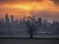 A December sunrise, Huntley, Gloucestershire (geograph 6721707).jpg 1,920 × 1,440; 455 KB
-
 A good year for the buttercup.. - geograph.org.uk - 3495822.jpg 1,024 × 680; 260 KB
-
 A natural frame - geograph.org.uk - 6140253.jpg 1,600 × 1,189; 679 KB
-
 A stand of Scots Pines - geograph.org.uk - 6030247.jpg 1,600 × 1,067; 554 KB
-
 A walk in the winter sunshine - geograph.org.uk - 5999134.jpg 1,600 × 903; 758 KB
-
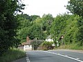
 A40 at Huntley - geograph.org.uk - 2590655.jpg 800 × 480; 328 KB
-
 A40 looking towards Gloucester - geograph.org.uk - 3105898.jpg 1,200 × 676; 381 KB
-
 A40 parking area in Huntley - geograph.org.uk - 3901436.jpg 800 × 486; 99 KB
-
 A40, bendy section - geograph.org.uk - 2044073.jpg 640 × 480; 234 KB
-
 A40, Ross Road, Huntley - geograph.org.uk - 6031971.jpg 1,600 × 900; 522 KB
-
 A4136 at Little London - geograph.org.uk - 1470149.jpg 640 × 480; 227 KB
-
 A4136 drops over the brow of the hill - geograph.org.uk - 2004518.jpg 640 × 480; 102 KB
-
 A4136 east to Huntley - geograph.org.uk - 1470151.jpg 640 × 480; 223 KB
-
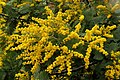 Acacia dealbata, Mimosa, 1 - geograph.org.uk - 6037082.jpg 1,600 × 1,069; 543 KB
-
 Acacia dealbata, Mimosa, 2 - geograph.org.uk - 6037086.jpg 1,200 × 1,600; 722 KB
-
 Acacia dealbata, Mimosa, 3 - geograph.org.uk - 6065802.jpg 800 × 568; 355 KB
-
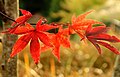
 Acer colours, 2019 - geograph.org.uk - 6309216.jpg 1,600 × 1,600; 2.29 MB
-
 Acer japonicum aconitifolium - geograph.org.uk - 5940852.jpg 1,600 × 972; 322 KB
-
 Acer japonicum Nicholsonii foliage, 1 - geograph.org.uk - 5953542.jpg 1,600 × 1,026; 655 KB
-
 Acer japonicum Nicholsonii foliage, 2 - geograph.org.uk - 5953546.jpg 1,396 × 1,600; 1,020 KB
-
 Acer palmatum 'Bloodgood' - geograph.org.uk - 6305968.jpg 1,600 × 1,600; 1.68 MB
-
 Acer palmatum 'Katsura' - geograph.org.uk - 6093428.jpg 1,600 × 1,173; 872 KB
-
 Acer palmatum 'Sangu Kaku' - geograph.org.uk - 6088052.jpg 800 × 601; 290 KB
-
 Allotments at Huntley - geograph.org.uk - 527743.jpg 640 × 480; 116 KB
-
 Animals grazing by the A40 - geograph.org.uk - 536660.jpg 640 × 483; 86 KB
-
 Approaching Huntley crossroads - geograph.org.uk - 2558804.jpg 800 × 600; 335 KB
-
 Arable land north of Huntley - geograph.org.uk - 4866051.jpg 1,600 × 901; 748 KB
-
 Autumn showers - geograph.org.uk - 6297243.jpg 1,600 × 902; 470 KB
-
 Baled crop of haylage - geograph.org.uk - 6235721.jpg 1,600 × 694; 376 KB
-
 Baled crop of haylage, 2 - geograph.org.uk - 6235729.jpg 1,600 × 700; 360 KB
-
 Bare trees in late April, Huntley - geograph.org.uk - 3795541.jpg 800 × 740; 191 KB
-
 Bee on Sedum flower - geograph.org.uk - 6291437.jpg 1,600 × 1,070; 853 KB
-
 Beef in afternoon sunshine - geograph.org.uk - 6230776.jpg 1,600 × 905; 545 KB
-
 Beehives in Cherry Wood - geograph.org.uk - 2209873.jpg 1,024 × 768; 447 KB
-
-
 Black and white cottage in Huntley - geograph.org.uk - 3795637.jpg 800 × 624; 106 KB
-
 Blue barn - geograph.org.uk - 2589306.jpg 800 × 481; 303 KB
-
 Bright's Hill - geograph.org.uk - 2400560.jpg 1,024 × 680; 248 KB
-
 Brush-cutting - geograph.org.uk - 6014982.jpg 1,600 × 900; 643 KB
-
 Buddleia in the wild - geograph.org.uk - 6210806.jpg 1,600 × 900; 537 KB
-
 Buddleia sp. - geograph.org.uk - 6210799.jpg 1,600 × 1,071; 774 KB
-
 Bumble Bees on Echinacea - geograph.org.uk - 6238762.jpg 1,600 × 1,066; 504 KB
-
 Bumble Bees on Echinacea, 2 - geograph.org.uk - 6246839.jpg 1,600 × 1,310; 751 KB
-
 Bus shelter in Huntley - geograph.org.uk - 3675262.jpg 800 × 451; 200 KB
-
 Bus shelter in Huntley - geograph.org.uk - 3701914.jpg 800 × 451; 199 KB
-
 Bus shelter on the A40, Huntley - geograph.org.uk - 5548480.jpg 2,048 × 1,536; 1.52 MB
-
 Bus stop on the A40 at Birdwood - geograph.org.uk - 536682.jpg 640 × 520; 76 KB
-
 Bus stop on the A4136 - geograph.org.uk - 3382463.jpg 640 × 427; 68 KB
-
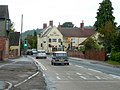
 Busy road at Huntley - geograph.org.uk - 2210253.jpg 1,024 × 768; 191 KB
-
 Buttercup meadow, Huntley - geograph.org.uk - 1880456.jpg 1,024 × 768; 446 KB
-
 Church, school and house in Huntley - geograph.org.uk - 3901533.jpg 800 × 554; 135 KB
-
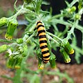 Cinnabar Moth caterpillar - geograph.org.uk - 6231118.jpg 1,597 × 1,600; 844 KB
-
 Clump of trees - geograph.org.uk - 3495833.jpg 1,024 × 680; 188 KB
-
 Colourful plant area at Leaf Creative - geograph.org.uk - 6302569.jpg 1,600 × 900; 706 KB
-
 Coming in to land - geograph.org.uk - 6246848.jpg 1,600 × 1,202; 742 KB
-
 Coppice Daw Pitch - geograph.org.uk - 4238665.jpg 800 × 513; 99 KB
-
-
 Cornus kousa Chinensis - geograph.org.uk - 6181101.jpg 1,600 × 1,189; 944 KB
-
 Cottages on the A40, Huntley - geograph.org.uk - 5548475.jpg 2,026 × 1,506; 741 KB
-
 Country Garden Centre near Huntley - geograph.org.uk - 1947334.jpg 1,500 × 1,000; 199 KB
-
 Country Garden Centre, Huntley - geograph.org.uk - 3901465.jpg 800 × 527; 135 KB
-
 Country road to Deep Filling - geograph.org.uk - 3495805.jpg 1,024 × 680; 257 KB
-
 Crop field at Huntley - geograph.org.uk - 486702.jpg 640 × 480; 388 KB
-
 Deep Filling - geograph.org.uk - 3495770.jpg 1,024 × 680; 311 KB
-
 Digging an overflow - geograph.org.uk - 6030534.jpg 1,600 × 903; 1.06 MB
-
 Display of autumn colour, 1 - geograph.org.uk - 3719445.jpg 800 × 450; 202 KB
-
 Display of autumn colour, 1 - geograph.org.uk - 3719450.jpg 800 × 450; 197 KB
-
 Distances from Huntley - geograph.org.uk - 3795514.jpg 800 × 537; 131 KB
-
 Distances from Huntley, Gloucestershire - geograph.org.uk - 3900931.jpg 800 × 709; 162 KB
-
 Double Hellebore - geograph.org.uk - 6024222.jpg 1,600 × 1,600; 1.23 MB
-
 Driveway to Home Farm, Huntley - geograph.org.uk - 5130512.jpg 1,024 × 768; 132 KB
-
 Eastern boundary of Huntley - geograph.org.uk - 3796789.jpg 800 × 478; 87 KB
-
 End of the 30mph zone through Huntley - geograph.org.uk - 3796900.jpg 800 × 698; 140 KB
-
 Entrance to Garden Centre Huntley - geograph.org.uk - 486715.jpg 640 × 480; 329 KB
-
 Ewes and lambs, Huntley - geograph.org.uk - 6065796.jpg 1,600 × 900; 524 KB
-
 Ewes and lambs, Huntley, 2 - geograph.org.uk - 6069475.jpg 1,600 × 901; 463 KB
-
 Fallen leaves - geograph.org.uk - 5973623.jpg 640 × 361; 190 KB
-
 Farmland near Round Hill - geograph.org.uk - 2210217.jpg 1,024 × 768; 276 KB
-
 Field below Cherry Wood - geograph.org.uk - 5158647.jpg 1,024 × 768; 134 KB
-
 Field by the A40, Huntley - geograph.org.uk - 5547969.jpg 2,304 × 1,728; 1.01 MB
-
 Football pitch, Huntley - geograph.org.uk - 3900950.jpg 800 × 600; 158 KB
-

-
 Footpath on Broom Hill - geograph.org.uk - 3495795.jpg 1,024 × 680; 301 KB
-
 Footpath to Huntley - geograph.org.uk - 3046544.jpg 1,200 × 900; 536 KB
-
 Footpath to Upper Ley - geograph.org.uk - 3574875.jpg 800 × 451; 191 KB
-
 Forest edge - geograph.org.uk - 3744460.jpg 800 × 450; 133 KB
-
 Forest Products on the A40, Huntley - geograph.org.uk - 5541925.jpg 1,938 × 1,436; 653 KB
-
 Forest Products timber yard - geograph.org.uk - 6310482.jpg 1,600 × 900; 579 KB
-

-
 Fountain and planting - geograph.org.uk - 1201435.jpg 640 × 480; 258 KB
-
 Frog Lane, Huntley - geograph.org.uk - 3796800.jpg 800 × 684; 175 KB
-
 Frogmore Road, Huntley - geograph.org.uk - 3796888.jpg 800 × 541; 111 KB
-
 Fungal fruiting bodies - geograph.org.uk - 6329047.jpg 1,600 × 1,006; 499 KB
-
 Gloucestershire dustmen flypast - geograph.org.uk - 1748105.jpg 640 × 480; 171 KB
-
 Gloucestershire Way and Woodend Farm - geograph.org.uk - 2504605.jpg 800 × 600; 382 KB
-
 Golden light over Huntley - geograph.org.uk - 2677996.jpg 1,024 × 577; 474 KB
-
 Golf access only, Huntley - geograph.org.uk - 3795790.jpg 800 × 713; 141 KB
-
 Gothic-style buildings by the A40 - geograph.org.uk - 3519291.jpg 800 × 600; 278 KB
-
 Grade II listed Huntley Court, Huntley - geograph.org.uk - 3901409.jpg 640 × 640; 128 KB
-

-
 Grassy fields near Huntley - geograph.org.uk - 6193448.jpg 1,600 × 901; 724 KB
-
 Grazing sheep, Huntley - geograph.org.uk - 3900980.jpg 800 × 539; 116 KB
-
 Great Tit young, Huntley, 1 - geograph.org.uk - 6145676.jpg 1,252 × 838; 375 KB
-
 Great Tit young, Huntley, 2 - geograph.org.uk - 6145677.jpg 1,600 × 1,068; 483 KB
-
 Great Tit young, Huntley, 3 - geograph.org.uk - 6145678.jpg 1,600 × 1,068; 467 KB
-
 Great Tit young, Huntley, 4 - geograph.org.uk - 6145680.jpg 1,600 × 1,068; 462 KB
-
 Great Tit young, Huntley, 5 - geograph.org.uk - 6145681.jpg 1,600 × 1,068; 458 KB
-
 Hamlen Close, Huntley - geograph.org.uk - 3796798.jpg 800 × 536; 116 KB
-
 Harvested grassland - geograph.org.uk - 3495811.jpg 1,024 × 680; 233 KB
-
 Hazel catkins, Corylus avellana - geograph.org.uk - 6071386.jpg 1,596 × 1,600; 883 KB
-
 High Victorian pairing, Huntley - geograph.org.uk - 3332972.jpg 3,243 × 2,101; 1.31 MB
-
 Hillside Grazers - geograph.org.uk - 533356.jpg 640 × 467; 85 KB
-
 Hinders Lane - geograph.org.uk - 1470184.jpg 640 × 480; 256 KB
-
 Hinders Lane - geograph.org.uk - 2210164.jpg 1,024 × 768; 339 KB
-
 Hinders Lane autumn 1 - geograph.org.uk - 2678247.jpg 1,024 × 768; 736 KB
-
 Hinders Lane autumn 2 - geograph.org.uk - 2678250.jpg 1,024 × 768; 763 KB
-
 Hinders Lane off the A4136 - geograph.org.uk - 3995945.jpg 1,600 × 1,064; 758 KB
-
 Honey Bee on Scabious - geograph.org.uk - 6238760.jpg 1,600 × 1,067; 509 KB
-
 Honey bee on Verbena bonariensis - geograph.org.uk - 6246844.jpg 1,600 × 1,175; 871 KB
-
 House at the edge of The Plantation - geograph.org.uk - 2209922.jpg 1,024 × 768; 291 KB
-
 House by the A40 - geograph.org.uk - 5973631.jpg 640 × 362; 131 KB
-
 House on the A40, Huntley - geograph.org.uk - 5547968.jpg 2,164 × 1,622; 841 KB
-
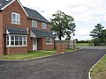
 House under construction - geograph.org.uk - 6008787.jpg 1,600 × 900; 462 KB
-
 House with three garages by the B4216 - geograph.org.uk - 2209904.jpg 1,024 × 768; 240 KB
-
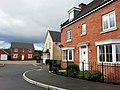
 Houses on the A40, Huntley - geograph.org.uk - 5558979.jpg 2,304 × 1,728; 850 KB
-
 Huntley autumn colour - geograph.org.uk - 2655873.jpg 800 × 451; 285 KB
-
 Huntley bus stops - geograph.org.uk - 3795516.jpg 800 × 573; 114 KB
-
-
 Huntley church treescape - geograph.org.uk - 6190081.jpg 1,600 × 900; 761 KB
-
 Huntley main street, 1 - geograph.org.uk - 4256369.jpg 800 × 451; 195 KB
-
 Huntley main street, 2 - geograph.org.uk - 4256370.jpg 800 × 600; 169 KB
-
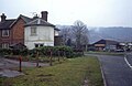
 Huntley Post Office and Village Shop - geograph.org.uk - 527740.jpg 640 × 515; 78 KB
-
 Huntley Quarry - geograph.org.uk - 2209934.jpg 1,024 × 768; 458 KB
-
 Huntley Service Station - geograph.org.uk - 2921585.jpg 1,024 × 577; 291 KB
-
 Huntley Village Hall - geograph.org.uk - 3796790.jpg 800 × 505; 105 KB
-
 Huntley Village Hall - geograph.org.uk - 3901027.jpg 800 × 788; 208 KB
-
 Huntley village stocks - geograph.org.uk - 4234753.jpg 800 × 600; 303 KB
-
 Huntley, by the crossroads - geograph.org.uk - 4067831.jpg 800 × 451; 204 KB
-
 Ilex verticillata, 'Winterberry' - geograph.org.uk - 5998097.jpg 1,600 × 1,318; 496 KB
-
 January sunrise - geograph.org.uk - 6030248.jpg 1,600 × 900; 450 KB
-

-
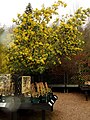
 Laburnum at its best - geograph.org.uk - 6180668.jpg 1,600 × 1,067; 655 KB
-
 Larch provides the colour - geograph.org.uk - 2691449.jpg 1,024 × 768; 726 KB
-
-
 Last vestiges of autumn - geograph.org.uk - 2703525.jpg 1,024 × 768; 683 KB
-
 Late October colour - geograph.org.uk - 2675397.jpg 1,024 × 578; 543 KB
-
 Leaf Creative garden centre - geograph.org.uk - 6216825.jpg 1,600 × 902; 512 KB
-
 Leaf Creative garden centre in the sunshine - geograph.org.uk - 6093424.jpg 1,600 × 1,067; 503 KB
-
 Ley Brook - geograph.org.uk - 1748100.jpg 640 × 480; 215 KB
-
 Liquidambar leaf - geograph.org.uk - 6310488.jpg 1,600 × 1,600; 1.87 MB
-
 Looking back towards junction - geograph.org.uk - 4996581.jpg 800 × 456; 69 KB
-
 Magnolia grandiflora - geograph.org.uk - 6193447.jpg 1,600 × 1,351; 628 KB
-
 Maize drills by the A40 - geograph.org.uk - 3505815.jpg 800 × 451; 202 KB
-
 Maize drills by the A40 at Huntley - geograph.org.uk - 3494356.jpg 800 × 600; 267 KB
-
 Maple leaf - geograph.org.uk - 6329063.jpg 1,598 × 1,600; 1.34 MB
-
 Mauve cottage by the A40 - geograph.org.uk - 3457274.jpg 800 × 620; 267 KB
-
 May Hill in the autumn - geograph.org.uk - 3211734.jpg 1,024 × 680; 248 KB
-
 Minor in the rain - geograph.org.uk - 2935104.jpg 1,024 × 577; 312 KB
-
 Minor road meets the A40 at Dursley Cross - geograph.org.uk - 724501.jpg 640 × 466; 186 KB
-
 Moat at Huntley - geograph.org.uk - 2209913.jpg 1,024 × 768; 347 KB
-
 Moated site, Huntley - geograph.org.uk - 6026353.jpg 1,600 × 901; 693 KB
-
 Moated site, Huntley, 2 - geograph.org.uk - 6140258.jpg 1,600 × 900; 523 KB
-
 Modern housing at Huntley - geograph.org.uk - 4251625.jpg 800 × 452; 165 KB
-
 Modern housing in Huntley - geograph.org.uk - 3933202.jpg 800 × 600; 232 KB
-
 Naturalised hellebore - geograph.org.uk - 6052982.jpg 1,600 × 1,201; 488 KB
-
 New housing at Huntley - geograph.org.uk - 527746.jpg 640 × 480; 117 KB
-
 Newent Lane, Huntley - geograph.org.uk - 3795568.jpg 800 × 559; 95 KB
-
 No through road in Huntley - geograph.org.uk - 3795531.jpg 800 × 600; 146 KB
-

-
 Nymphaea in a small pond - geograph.org.uk - 6207468.jpg 1,600 × 1,600; 785 KB
-
 Oak Way houses in Huntley - geograph.org.uk - 3795589.jpg 800 × 571; 111 KB
-
 Old Barn, Charlotte's Farm - geograph.org.uk - 139746.jpg 640 × 479; 101 KB
-
 Old cider press - geograph.org.uk - 3384662.jpg 640 × 427; 98 KB
-
 Old oak in a buttercup meadow - geograph.org.uk - 1880466.jpg 2,048 × 1,536; 910 KB
-
 Old Toll House by Broom Hill, Huntley - geograph.org.uk - 6115333.jpg 1,024 × 664; 116 KB
-
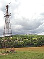 Old windpump at Gander's Green - geograph.org.uk - 2207006.jpg 760 × 1,024; 143 KB
-

-
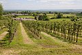 Orchard above Woodend Farm - geograph.org.uk - 3495785.jpg 1,024 × 680; 271 KB
-
 Orchard Bank Farm - geograph.org.uk - 3382278.jpg 640 × 427; 51 KB
-
 Orchard Close, Huntley - geograph.org.uk - 3481514.jpg 800 × 451; 203 KB
-
 Orchard east of Huntley Hill - geograph.org.uk - 2209937.jpg 1,024 × 768; 316 KB
-
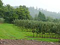 Orchards on Huntley Hill - geograph.org.uk - 1470180.jpg 640 × 480; 264 KB
-
 Ornamental pond - geograph.org.uk - 6276871.jpg 1,600 × 900; 957 KB
-
 Parkland, Huntley Manor - geograph.org.uk - 2189406.jpg 640 × 481; 248 KB
-
 Path from Newent Lane, Huntley - geograph.org.uk - 6310414.jpg 1,600 × 900; 627 KB
-
 Path into the woods - geograph.org.uk - 6297248.jpg 1,600 × 900; 1 MB
-
 Pathway to Huntley - geograph.org.uk - 2206884.jpg 768 × 1,024; 366 KB
-
 Pebbles sand gravel and grit - geograph.org.uk - 486721.jpg 640 × 480; 506 KB
-
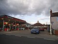 Petrol station on the A40, Huntley - geograph.org.uk - 5541102.jpg 2,304 × 1,728; 868 KB
-
 Pile of old pallets - geograph.org.uk - 3572620.jpg 800 × 600; 259 KB
-
 Plants by the entrance of Leaf Creative - geograph.org.uk - 5939257.jpg 1,600 × 1,298; 1.34 MB
-
 Post office at Huntley, Gloucestershire. (2988927969).jpg 960 × 1,280; 155 KB
-
 Postbox and house - geograph.org.uk - 3382473.jpg 427 × 640; 71 KB
-
 Pot display at garden centre - geograph.org.uk - 486722.jpg 640 × 480; 459 KB
-
 Prunus sp. in flower - geograph.org.uk - 6097087.jpg 1,600 × 1,200; 843 KB
-
 Public path to Newent - geograph.org.uk - 6310417.jpg 1,600 × 900; 870 KB
-
 Rain on Acer foliage - geograph.org.uk - 6276213.jpg 1,600 × 1,069; 480 KB
-
 Rainclouds over Huntley - geograph.org.uk - 6173099.jpg 1,600 × 901; 385 KB


.jpg)


.jpg)


